The Scout Loop Trail
For Massachusetts Department of conservation and recreation
- Scout
- Noah Shupenko
- Location
- Georgetown, Massachusetts
- Completed
- 2025
- Unit
- 51
- Council
- Spirit Of Adventure
- Volunteer hours
- 64
About the project
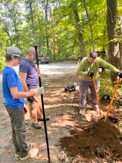
After spending a significant amount of time in the local state forest that ran through my town, I noticed that there was a lack of dedicated signage and directional markings, which made navigation in the state forest more based on memory than maps. As such, I’m mapped out a 2 mile loop where I was able to implement directional markings in the form of painted blazes and a sign with all of the the distance information as well as a satellite overview of the trail. Access was also added to an area of the state forest that floods frequently due to the existence of beaver dams, done by using paving stones to construct an elevated path through the area.
Project photos
Select a photo to enlarge it.
Need help with this project?
Contact EagleBase about corrections, ownership questions, updates, or anything else related to this archive entry.
Contact EagleBase →See something inaccurate?
For privacy concerns, safety issues, or a formal removal request, use the report form.
Report or request removal →